Holding Point is Bannermedia’s flight-sim label. It has two parts. The add-ons are the products: plugins for X-Plane 12. The flight simulator is the free front door. As of today it is live at holdingpoint.studio/fly.
What it is
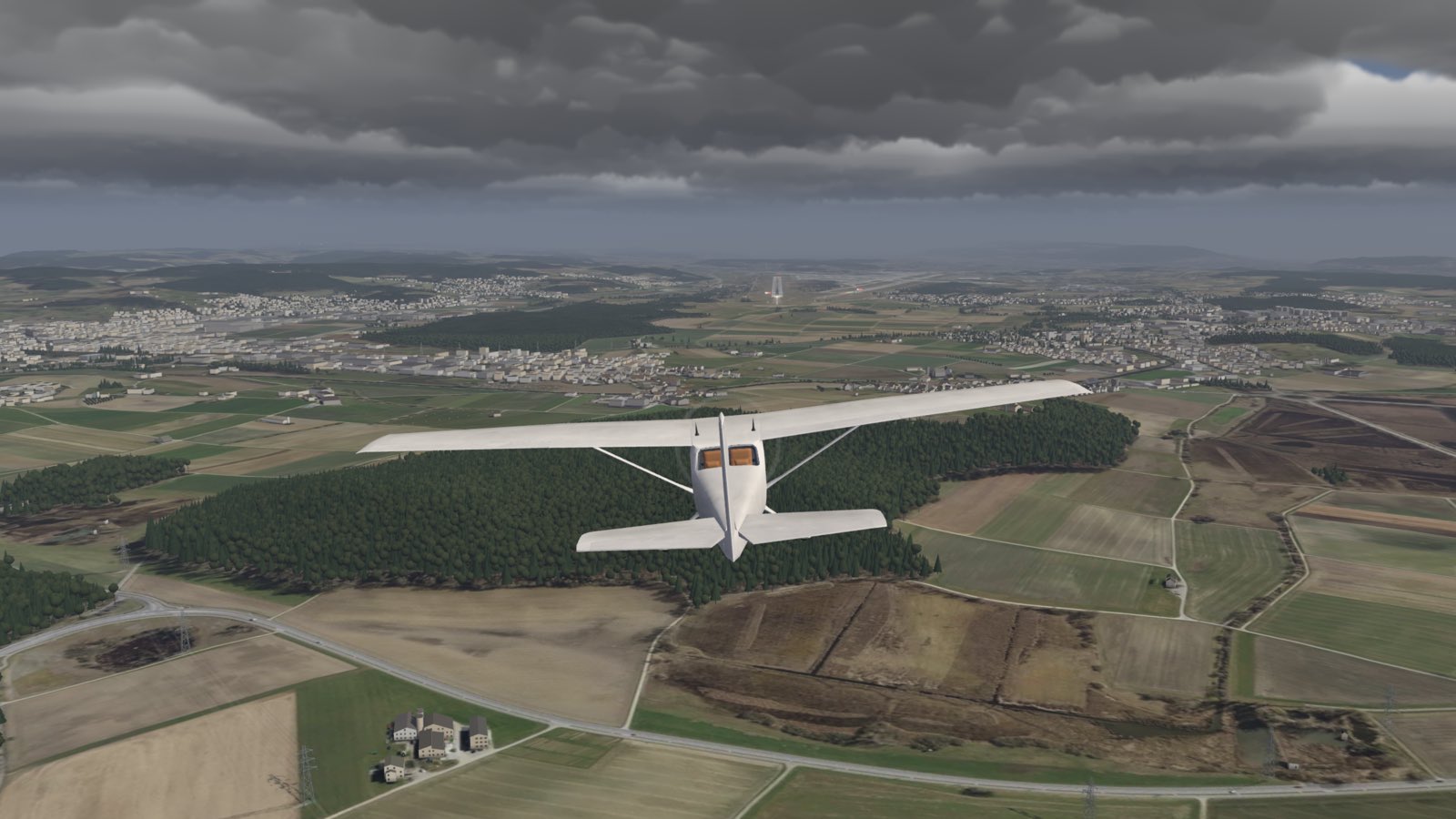
Press Fly now and you are 3.5 nm out on final for runway 14 at Zurich, in a four-seat light trainer. Land it, and a score card marks you out of 100 on sink rate, centreline, touchdown point and flare. The debrief then says where you left the localiser or the glideslope, in plain words: “Drifted left of the localiser at 600 ft.”
The scoring follows published practice. The stabilised gate sits at 1,000 ft above the runway, from the Flight Safety Foundation’s briefing note on stabilised approaches. The decision height is the 200 ft CAT I figure from ICAO Annex 6.
It is free. There is no download, no account and no payment. It works with a keyboard, a game pad, or a stick, yoke and pedals through the browser’s Gamepad API. On a phone you fly with an on-screen stick and levers.
The simulator is for familiarisation and fun. It is not an approved training device, and it gives no training credit with the CAA, EASA, the FAA or any other authority. Learn to fly with an approved training organisation and a qualified instructor.
Why a browser
A desktop simulator asks a lot before you fly: a large download, an install, often a licence. That is fine once you are hooked. It is a poor way to try one approach. A link asks for a single click.
So the simulator lives at one address. Send it to a friend, open it on a laptop in a hotel, try an approach on the train. If the flying hooks you, the add-ons take that interest into X-Plane 12.
How it is built
Rendering uses Three.js with its WebGPU renderer and node-based shaders. Where a browser has no WebGPU, the simulator falls back to WebGL. The look is built for WebGPU, and every picture on this page comes from that path.
The flight model runs in a sim core written in Rust and compiled to WebAssembly. The trainer’s numbers come from published data: the type’s owner’s handbook, NASA and NACA reports, and the open JSBSim model. It models the stall, propeller torque and P-factor, ground effect, and weight and balance. The simulator’s own page lists each source.
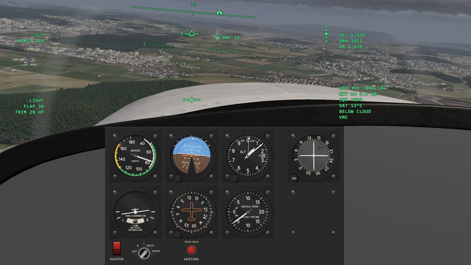
The scenery is real data, not a painted backdrop. Terrain and aerial imagery around Zurich come from swisstopo. The far terrain comes from the Copernicus WorldDEM-90. Roads and the runway come from OpenStreetMap, and the forests from the Swiss National Forest Inventory. The runway sits where the real one lies, at the real length and heading.
Weather starts calm, because scores compare only in calm air. A switch in the settings loads the real weather report for Zurich and flies you through it. Presets cover a crosswind, low cloud, gusts and high cirrus.
Fly mode sends no flight or score data anywhere. The site counts visits with cookie-free analytics, and it runs on EU servers.
The add-ons
HeadphonesXP is a plugin for X-Plane 12 on Mac and Windows. It makes the sim sound the way it does through an aviation headset. Engine and wind sit back; the radio stays clear, so you catch every clearance. Two profiles model a passive general aviation headset and an active noise reduction headset. It has a $9.99 launch price and a 20-minute trial on every flight. Details are on the HeadphonesXP page.
Try it
Open holdingpoint.studio/fly and press Fly now. Arrow keys fly, T and G set the power, and H shows every key. Then land it and see your score.
Map and data credits: imagery and terrain © swisstopo; includes material © (2016-2018) Planet; far terrain produced using Copernicus WorldDEM-90 © DLR e.V. 2010-2014 and © Airbus Defence and Space GmbH 2014-2018, provided under COPERNICUS by the European Union and ESA; © OpenStreetMap contributors; vegetation height FOEN/WSL, Swiss National Forest Inventory.